
Edisto Museum
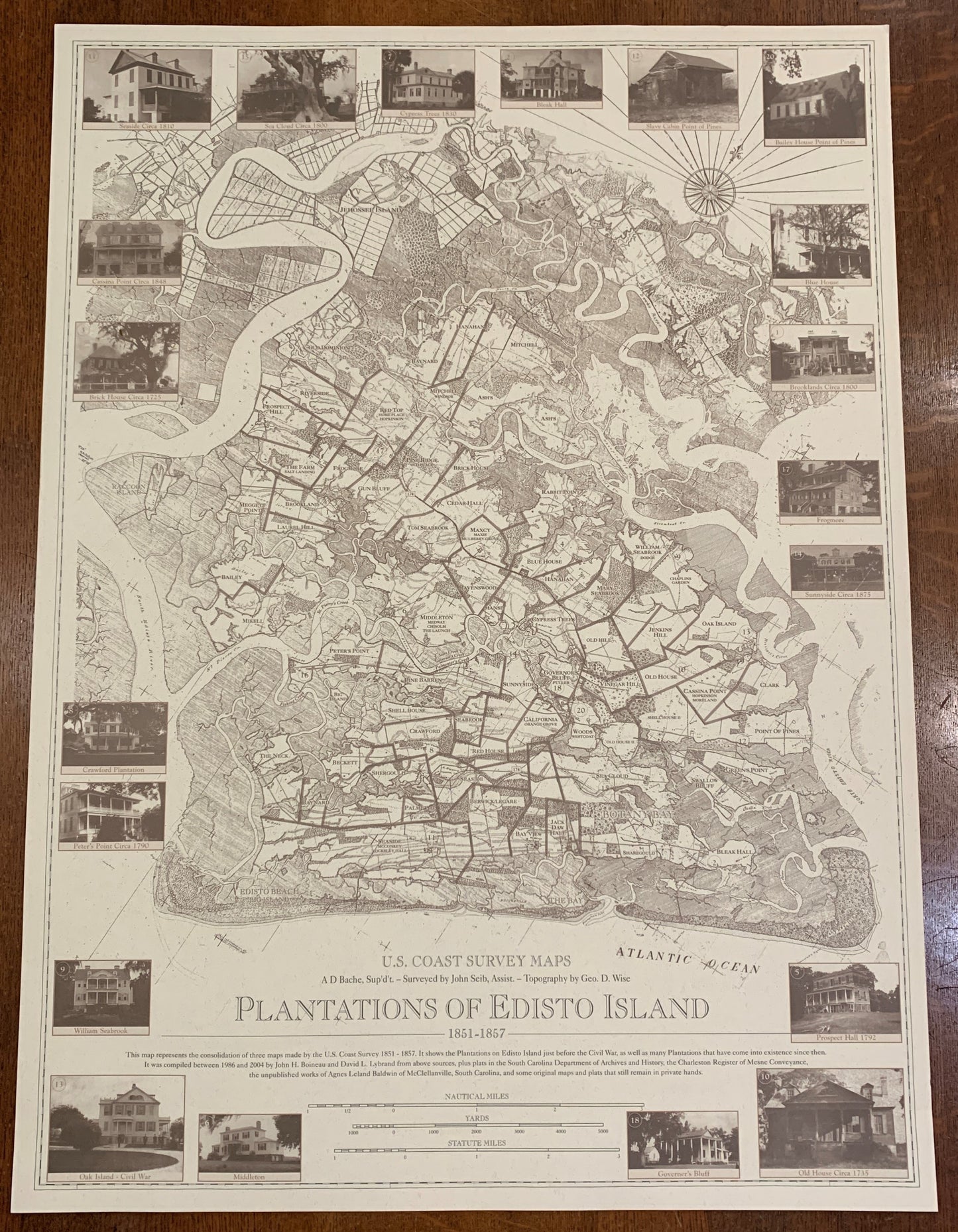
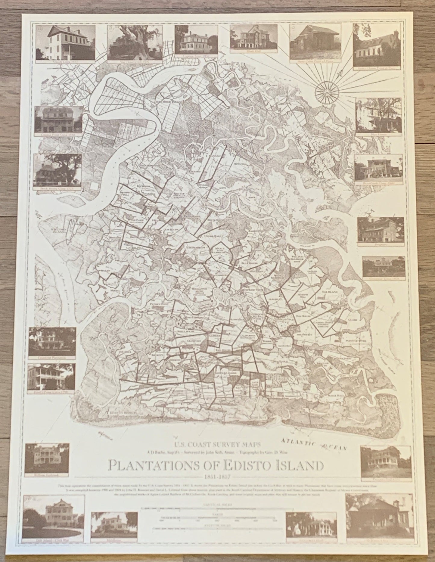
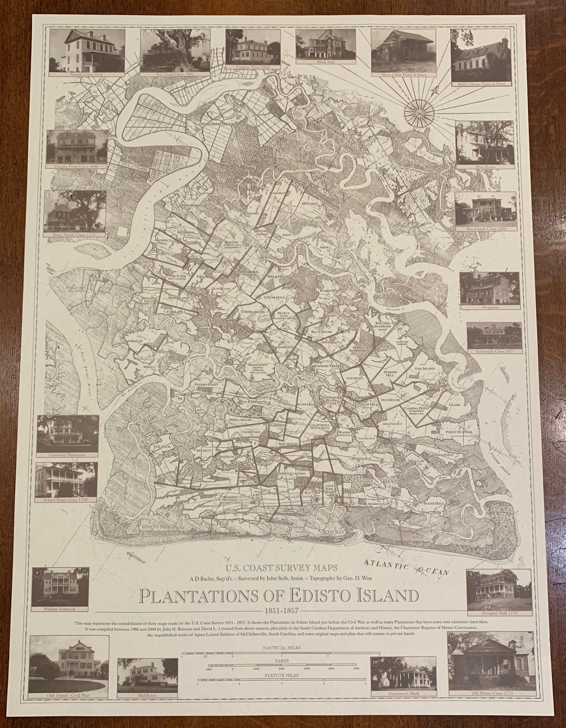
Edisto Island 1850's Plantations Map in Two Sizes
Edisto Island 1850's Plantations Map in Two Sizes
Regular price
$40.00 USD
Regular price
Sale price
$40.00 USD
Unit price
per
Couldn't load pickup availability
Based on maps drawn in the 1850's by the U. S. Coast survey.
Plantations are shown with their 1850's name and subsequent names, and SC Highway 174 has been added.
The large map measures 33 1/2" x 24 1/2" and looks magnificent framed on a wall.
The small map measures 16 3/4" x 12" and is available at 50% off the original price of $20.00.
Both are a sepia brown and cream color.
There is a $5.00 surcharge on the large map as it requires special packaging, it is included in the price.